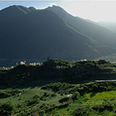
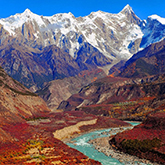
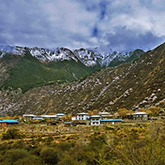
“On both sides of the Yarlung Zangbo River Grand Canyon, the towering Nanjiabawa Peak (7782 meters above sea level) and Gala Bailei Peak (7234 meters above sea level) are all strong ascending fault blocks, standing tall and straight into the clouds. The glaciers hang over the peaks and mountains, and the clouds are misty.”
“From the air or from the mountain pass of Xixingla and other bird's-eye views of the Grand Canyon, among the countless snow peaks and green mountains of the Eastern Himalayas, the Yarlung Zangbo River cut out a steep canyon, crossing the high mountain barrier, and making a peculiarity around Nanjiabawa Peak The great turn of the southward dive into the Indian Ocean, its magnificent and peculiar.”
“The deepest part of the Yarlung Zangbo River Grand Canyon between Nanjiabawa Peak and Gala Bailei Peak reaches 5382 meters. It surrounds the core river section of Nanjiabawa Peak and has an average depth of about 5000 meters. The Grand Canyon of Colorado, the Colca Canyon at 3,200 meters deep and the Kriginge Grand Canyon at 4,403 meters deep.”
“The Yarlung Zangbo River Grand Canyon is the largest water vapor channel on the Qinghai-Tibet Plateau. Affected by the warm and humid air flow in the Indian Ocean, the annual precipitation in the southern section of the Grand Canyon is as high as 4000 mm and the northern section is also between 1500-2000 mm. Covered with dense forests, it forms the most biologically diverse canyon in the world. It is different from the arid Colca Canyon with desert vegetation and the more arid Colorado Canyon with a single pine forest.”
“The forests of the Yarlung Zangbo River Grand Canyon are lush. Due to the steep terrain, inconvenient transportation, sparsely populated, and many sections of the river are not populated at all, plus the Grand Canyon cloud cover fog, mysterious, so the environment is particularly quiet. This is also unmatched by the above three grand canyons.”
“The Yarlung Zangbo River Grand Canyon circumnavigates Nanjiabawa Peak in a continuous gorge, which is 496.3 kilometers long, 56 kilometers longer than the Grand Canyon of Colorado, known as the "longest" in the world.”
“Many of the sections of the Yarlung Zangbo River Grand Canyon are rocky on both sides of the river, and are simply impassable, so no one has ever walked through the canyon. Compared with the other three grand canyons, there are roads in the valley; Colorado Grand Canyon, visitors can travel through the valley with livestock; Colca Grand Canyon, visitors can travel along the valley; Kaligende Grand Canyon, the villages in the valley are dotted The trail along the valley is the main route for the development of local hiking tourism. As far as the water channel is concerned, the average flow of the Yarlung Zangbo River Grand Canyon reaches 4425m³ / s, far more than 67 cubic meters of the Colorado River and the other two rivers. The flow velocity of the river is as high as 16m / s. Close to the entrance of the Grand Canyon, the water surface fell at an altitude of 2910 meters and fell out of the Tibet Autonomous Region”
“It refers to Baxiqa at the lowest point of the Yarlung Zangbo River Grand Canyon, which is only 155 meters above sea level, far lower than any of the lowest points of the above three canyons.”
“The most bizarre of the Yarlung Zangbo River Grand Canyon is that it trails southwards from the east to the west in the Eastern Himalayas, and then along the southern slope of the Eastern Himalayas grabs its way down into the Indian Ocean to form the most bizarre horseshoe-shaped turn in the world. It is not only peculiarly peculiar in the landform landscape, but also a grand canyon with a unique water vapor channel in the world, creating a peculiar forest ecosystem landscape on the southeastern edge of the Tibetan Plateau.”
“The natural landscape of the entire Grand Canyon can be summarized by "Yaluzangbu River Grand Canyon Xiujia World". The so-called world of Xiu Jia mainly refers to the uniqueness in the show's breadth, depth and strength. In terms of breadth, the Grand Canyon is a mountain show, a water show, a tree show, a grass show, a cloud show, a fog show, a beast show, a bird show, a butterfly show, a fish show, a human show, a village show ... not only that, the Grand Canyon The show has its profound and majestic connotation. For example, the water of the Grand Canyon, from solid ice and snow to boiling hot springs, from trickle streams, curtain waterfalls to torrential rivers, solid, liquid, gaseous, snowflakes, streams, large rivers, beauty, and various forms of water, Various scales. In terms of strength, the waterfall of hundreds of meters, the velocity of 16m / s and the flow of 4425m³ / s are very spectacular. Like the Grand Canyon”
-
Daduka Ruins
VoiceThe starting point of the Yarlung Zangbo Grand Canyon is the Daduka Ruins. The legendary Daduka Ruins is the castle of King Gongbu. It was destroyed by the war between King Gongbu and King Bomi about 500 years ago. The King of Gongbu we are talking about here refers to the Tuwang who once ruled the three counties of Linzhi, Milin, and Gongbujiangda. It is said that the earliest King of Gongbu was the royal descendant of the powerful Tubo dynasty. Now we often refer to the "Gongbu Tibetans", that is, the Tibetan compatriots in the areas they rule. After the meeting, please follow the tour trails, do not climb at will, protect the environment, everyone is responsible. Please everyone travel civilized.
-
Millennium Mulberry
VoiceWhat we see now is the millennium mulberry tree, which is said to have been planted by Songzanganbu and Princess Wencheng in order to witness the love of each other. Everyone in Tibet will find a very interesting story about Princess Wencheng's entry into Tibet. Many people in Tibetan areas will say that Princess Wencheng arrived in the holy city of Lhasa through their hometown. Similarly, this is also spread in the Grand Canyon area. Legend, and also said that Princess Wencheng stayed in Linzhi for three years. The reason why there is such a legend is that the Tibetan compatriots hope that Princess Wencheng can bring good luck to the hometown and fabricate it in good faith. In fact, the route of Princess Wencheng into Tibet is basically the same as the Qinghai section of the Qinghai-Tibet Highway and the Tibet section of the northern Sichuan-Tibet line. But these beautiful wishes bring us a lot of beautiful and moving legends.
-
Viewpoint
VoiceNanjiabawa Peak Group is a transtropical zone and a cold zone. It is located at the intersection of Milin County, Nyingchi County, and Motuo County within the Yarlung Zangbo Grand Canyon. Its altitude is 7782 meters, ranking 15th in the world , And the top 14 are all peaks above 8000 meters above sea level, so Nanjiabawa is the highest in the 7000 meters above sea level and the highest peak in the Eastern Himalayas. There is a "Shame Peak (because of its huge triangular peak Snow all year round, clouds lingering, never easily reveal the true colors) "and" heaven in the cloud "reputation. Nanga Bawa is interpreted in Tibetan as "Thunderbolt burns like fire". And because in the world ’s longest epic "King of Gesar", Nanga Bava is likened to a "spear piercing the sky"; therefore, Nanga Bava is also called "the battle of straight piercing the sky spear".
-
Hydrophilic platform
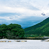
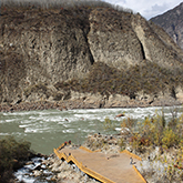
VoiceThe back of the hydrophilic platform is located on the west side of Nanga Bava, facing the stormy dangerous beach of the Yarlung Zangbo Grand Canyon. In addition to being able to fully experience the surging power of waves, here you can also learn about the geology and earthquake history of the entire Grand Canyon area. The dirt road we walked through a poplar forest. In the entire Grand Canyon area, this section and the poplar forest on the other side of the river are particularly concentrated. What is the reason? In fact, this is related to the earthquake. The section we are currently in is a debris flow accumulation layer. The debris comes from the trench behind the bridge, and the upper part of the trench is the glacier on the western slope of Nanjiabawa Peak. Historically, this is the frequency of earthquakes and debris. Especially in the great earthquake of August 1950, the glacial debris flow and the large amount of mud wrapped in the torrents of torrents seemed to go down from the sky, rushing into Yarlung Zangbo almost instantly
-
Zhibai Village
VoiceThe Tibetan meaning of Zhibai Village means “there are many places to turn the meridian”. In fact, this Zhibai village was rebuilt later. The earliest village was destroyed in the Moto earthquake of 1950. The earthquake also triggered a large-scale avalanche of two snow peaks. The ice tongue on the lower section of Zelonglong Glacier on Nanjiabawa Peak suddenly fell. The ice body combined with the avalanche, overturned a small hill and buried the Zhibai village not far from the entrance of the Grand Canyon, and rushed into Yarlung Zangbo, causing the river to block for several hours, forming a barrier lake, making the downstream-with river water Completely dry, villagers can even go to the river bed to pick up fish. Zhibai Village is a village under the cliff of 5,000 meters west of Nanga Bawa. It is the closest viewing point to Nanga Bawa and Peng Feng. It is also known as the most beautiful village under the west wall of Nanga Bawa. Very beautiful village, surrounding landscape

 AAAA Scenic Area
 Wechat applet


